Let’s face it: diving in the high desert of Southeast Oregon gets a bad rap. It’s a long way from the closest SCUBA shop and compressor to this part of Oregon. Viz in the summer can be nil. There are only a few rocks and trout to look at underwater. The list of complaints goes on and on.
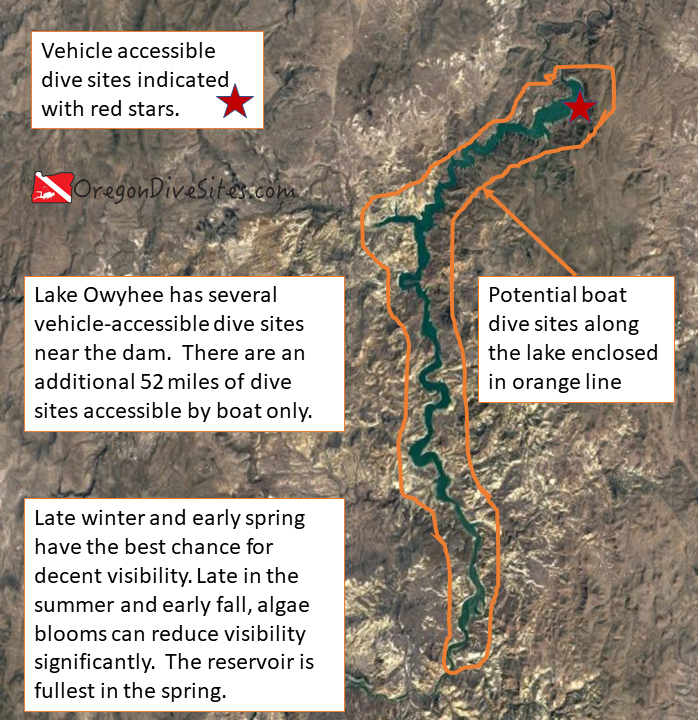
In spite of some of these shortcomings, Indian Creek Campground has some pretty awesome diving because of the island (usually a peninsula when the lake isn’t full) with its steep cliffs. This is probably the most fun dive site of the car-accessible shore diving sites along Lake Owyhee. If you get bored of doing these sites, there are 52 miles of dive sites along the lake that are accessible by boat. And as luck would have it, Indian Creek Campground has a boat ramp.
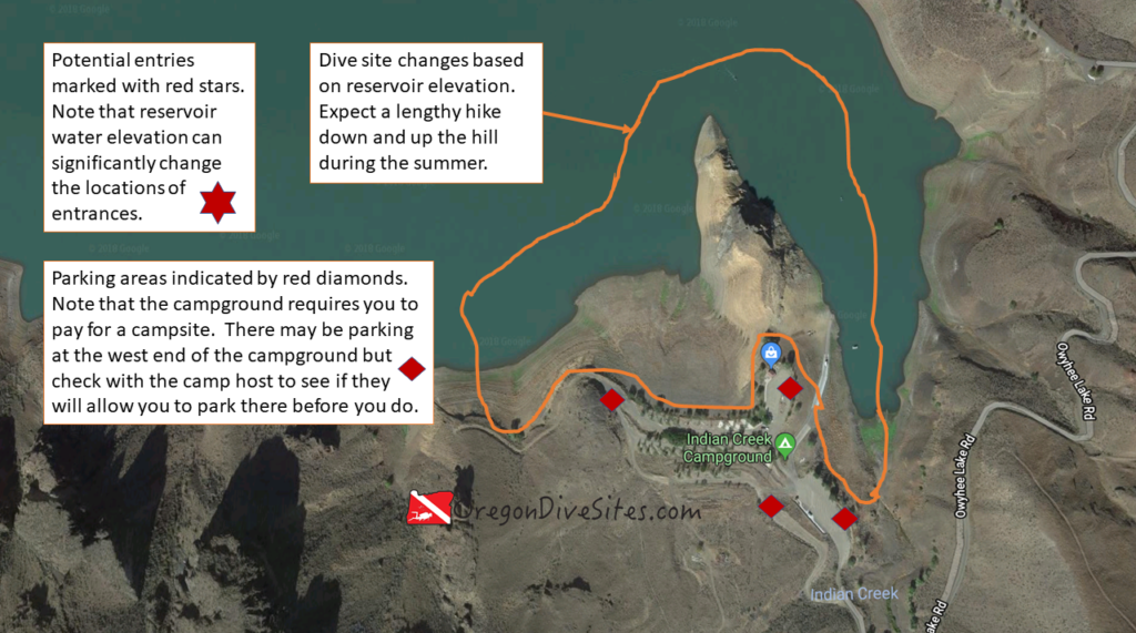
Imagery ©2018 Google, Map data ©2018 Google.
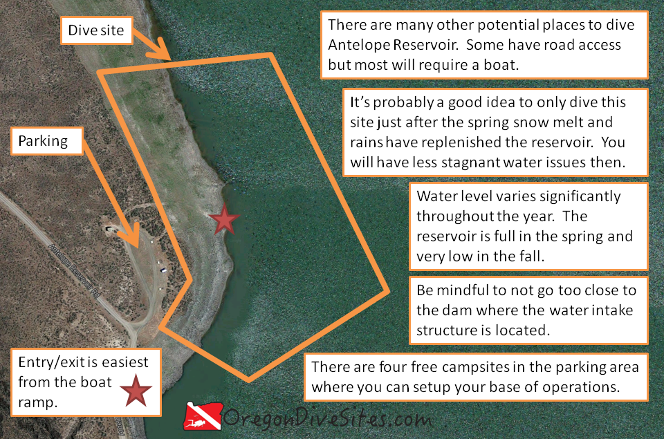
There are several other dive sites at Lake Owyhee worth mentioning including:
- Lake Owyhee Reservoir: At 52 miles long, this reservoir has a huge number of dive sites for those with access to a good boat. The reservoir sits down in a canyon which makes for interesting wall dives.
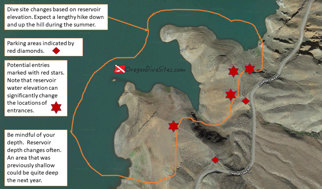
- Owyhee Lake Road Pull-Outs: You can dive at the two pull-outs before the first boat ramp.
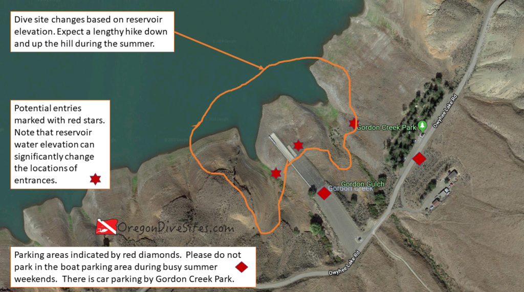
- Gordon Creek Park and Gordon Boat Ramp: There is some interesting topography to the west of the boat ramp.
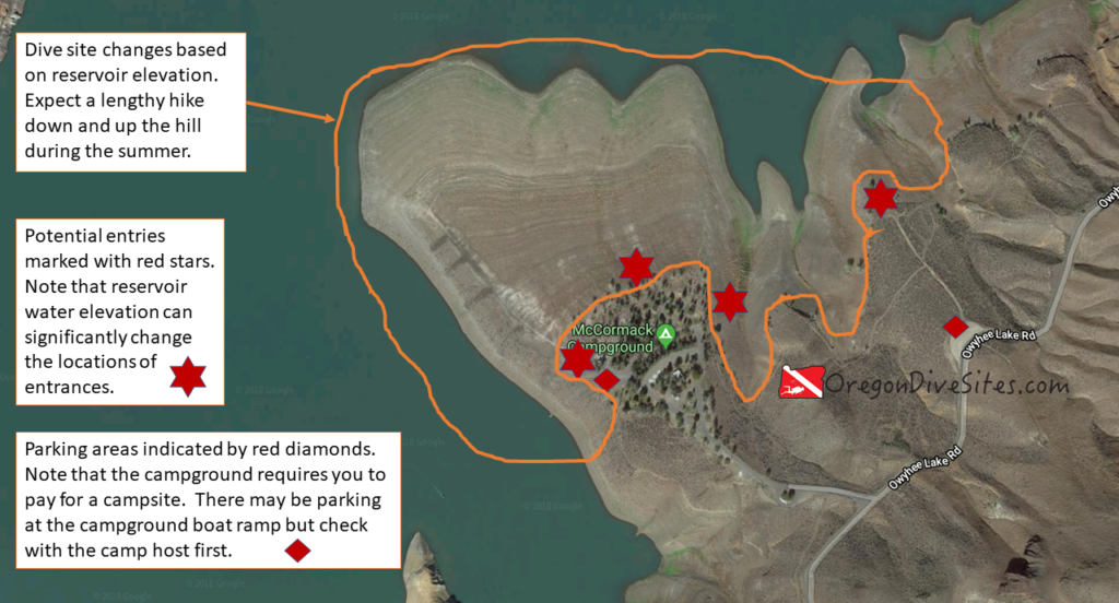
- McCormack Campground: This is a great place to base out of to dive the area. You can walk from your campsite directly to the water.
Nearest Town:
Adrian, Oregon
GPS Coordinates:
Parking:
Check with the campground hosts or the store and boat ramp operator before you park. During busy summer months, parking can be hard to come by.
Site Orientation:
The main attraction here is the island (peninsula during low water times) just north of the store. The island runs north-south. The east side has the more dramatic topography to dive but the whole thing is worth a look.
Entrances and Exits:
Watch for slick mud near the waterline when the water level has been falling. Check with the boat ramp attendant or in the store before using the boat ramp as an entrance. Watch for boat traffic — boaters aren’t used to seeing divers here.
Salt/Fresh:
This is a fresh water dive.
Shore/Boat:
This is a shore dive but can also be dived with a boat. A boat could be useful to get to the very northern tip of the island.
Normal Conditions:
There may be a few waves from boat wakes. Also currents can crop up when the dam is spilling a lot of water.
Normal Visibility:
At the height of summer, viz can be nil due to algae blooms. In the late winter and spring, viz can get up to 30 feet when cold, clean water flows into the reservoir.
Normal Temperature:
In the winter, temperatures can dip into the 30s. In late summer during low water years, temps can be in the 60s.
Best Time of Year:
Try diving here in the spring when the reservoir is the fullest and you have the best chance of good viz at Indian Creek Campground.
Max Depth:
You might find 100 feet in the middle of the channel if the lake is full.
Suggested Special Training:
This is an altitude dive site so be sure to have appropriate training.
Difficulty of Dive:
The dive is rated intermediate because of the altitude requirements. Also it can be easy to go far enough from your entrance that you might need a lengthy surface swim back.
Distance of Walk to Entrance:
If you can park by the store and the reservoir is full, you will only have to go a few feet. Otherwise, expect a few hundred feet to a thousand foot walk.
Surface Swim Length:
No surface swim is necessary although you might want to swim a few hundred feet north along the island.
Nearby Places to Camp and Diver-Friendly Hotels:
The campground here is a good place to base out of for a few days of exploring Lake Owyhee. There are a few other campgrounds in the neighborhood as well.
What Other People Have to Say About This Site:
Please write in the comments below your experiences with this dive site!